
Offroad adventure – Skjaldbreidur- Langjokull January 2004

Skjaldbreidur – Langjokull
31. January 2004
The journey starts early in the cold winter morning. The temperature reads -14°C.
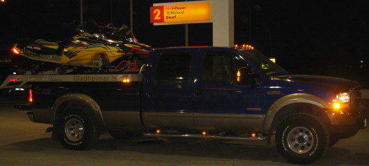
Me and Einar Kjartansson meet at a popular gas station in Reykjavik. The weather forecast for the day is good. Many other travelers are getting ready to enjoy the day. Among them we see this truck carrying two snowmobiles. At 9 o’clock it is still dark. We fill our tanks and I fill an extra container.
When we reach Lake Thingvellir (Þingvallavatn), the sun is almost up and we stop to enjoy the view over the lake. Einar is connecting his GPS to his laptop for navigation.
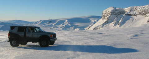
From our viewpoint at Lake Thingvellir we see our first designated destination, Skjaldbreidur. The mountain is in the far back and looks just like a big shield.
Thingvellir is a place where you can clearly see the continental drift of Europe and North America.
The rift is a part of a greater dislocation at the area.

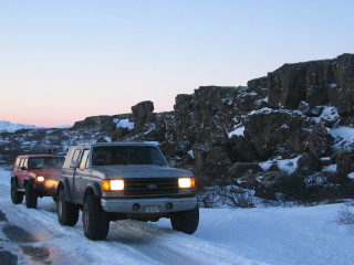
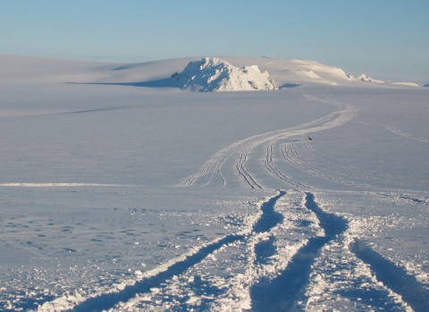
A little north of the lake we get off-road for the first time in the trip. At that time we decide to air-down, mostly to make the journey a softer ride.
Skjaldbreidur is a volcano and has a big crater at the top (1060m). The view makes the day. It is just exceptional!
On a clear day you can see 9 different icecaps or glaciers from the mountain.
In the back you can see one of the largest, Langjokull.
Einar decides to descend down in the crater.
Getting up was of course more of a challenge!
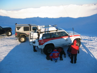
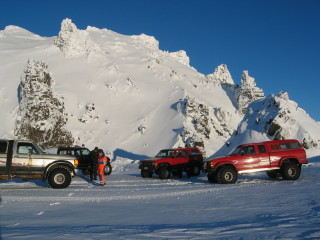
At the top of Skjalbreidur we met a couple of rescue-unit trucks on a practice mission.
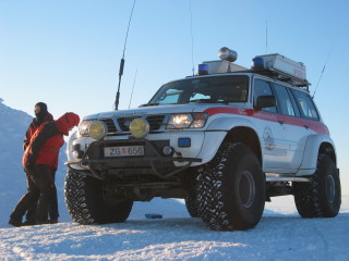
This one is a Nissan Patrol with 44 inch Dick Cepec
F-C tires.
Even though it is almost noon the sun does not reach the bottom of the crater.
The rescue-unit is fixing the sidestep that had been replaced after a damage in an earlier trip.
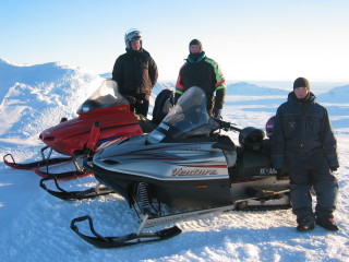
Traveling by snowmobile is also a good option here.
These guy’s are also at Skjaldbreidur.
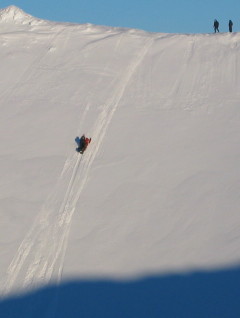
The snowmobiles can ascend great steepness as can be seen in this picture from the far side of the crater.
This is practically vertical!
After descending from Skjaldbreidur we head for Langjokull.
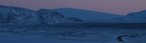
Here we stop along the way. The landscape is beautiful.
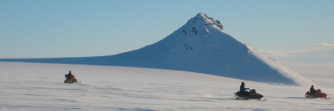
On the way up Langjokull we meet these snowmobiles. They can easily do over 100 km/hour (60 miles/hour). The pyramid shaped mountain is named Klakkur.
In the far back you can still see Skjaldbreidur. A bit closer is Thorisjokull (Þórisjökull) and to the right the side Geitlandsjokull is towering over. That is going to be our next stop.
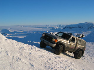
Geitlandsjokull (1395m) is at the south end of Langjokull. To get there we have to reach it from the north, from Langjokull.
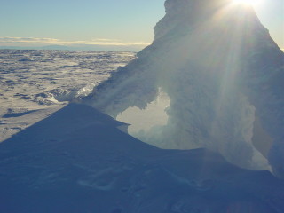
At the top of Geitlandsjokull there is this mast all covered with ice.
The temperature is now around -20°C.
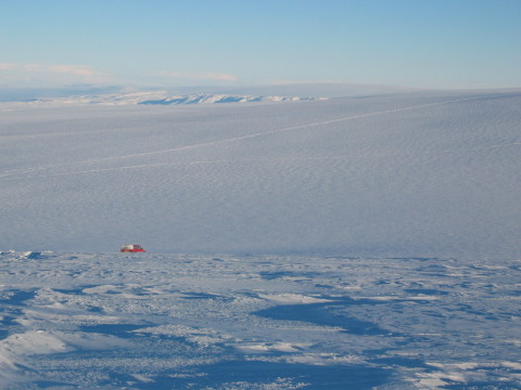
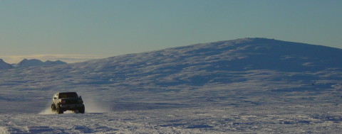
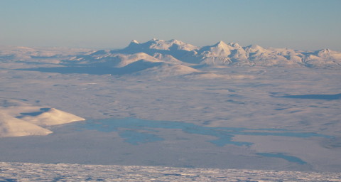
Getting down from Geitlandsjokull we can see along Langjokull. Only snow and ice as far as the eye can see. Langjokull (1450m) is around 100 km. long! Langjokull is the second largest icecap in Iceland.
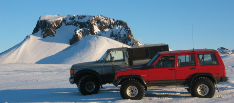
Here is a Ford Econoline that has been modified to be a 4×4. This one we pass driving along with an old Bronco and a
GMC van.
In the middle of the icecap rises Thursaborg (Þursaborg 1370m). It is one of my favorite places.
As can be seen by the tracks, the snow is getting heavier.
This Land Cruiser on 38″ Trxus tires, was among a group we meet.
Taking a stop at Thursaborg.
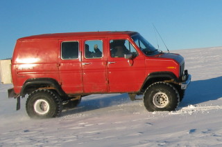
The red truck is a Ford Ranger on 38″.
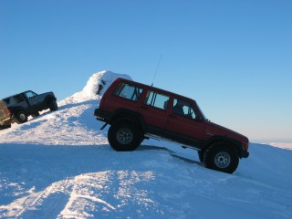
The proud owner of this Cherokee, has recently modified it for 44″, but here it is on 38″ Dick Cepec’s. The suspension is air-springs front and back. The fender flares are home made by him!
The nameplate reads “RUDDI” which means “ROUGHNECK”.
Eiríksjökull can be seen in the back.
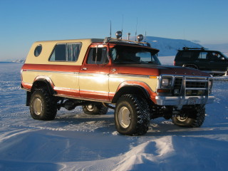
This old F-250 has been nicely converted to be an extra long Bronco.
The daylight will soon be out so we must be heading our way.
Descending from Langjokull on the south-east side we get an excellent view over to Kerlingarfjoll in the rear and can see Black river (Svartá). Kerlingarfjoll are mountains just south of Hofsjokull (the third largest icecap in Iceland).
On the way back we stopp at the gas station at Geysir. This six wheeled 44 inch Econoline is taking tourists to the mountains.
At six o’clock it is again getting dark.
I hope you have enjoyed the story!
[author]