
Portable GPS Navigators
Portable GPS Navigators
![]()
Traveling in a strange and unknown land is always difficult. Portable GPS navigators are becoming ever more popular to help find the right way. People have used compasses and maps to learn their way and before that Vikings used stars and the height of the sun to sail for long journeys on the big unknown ocean.
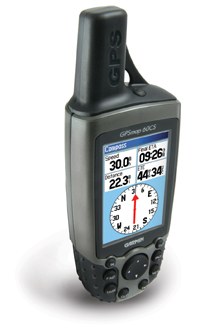
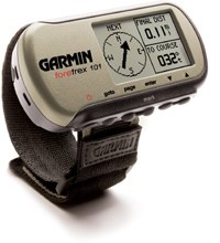
Modern days of computers and satellites has brought us ever more accuracy in finding our present location on our planet earth. Portable GPS navigators are based on the Global Positioning System. GPS is only a little over a decade old now. It is now used for the most accurate positioning available with receivers that are easy to keep in the off road vehicle and even carrying along for hiking tours. There are even some wrist watches with GPS built in!
GPS is based on 24 satellites circling around the earth in 20,200 km height (12,552 miles) and transmitting radio signals down to us. Satellites transmit signals with information about their exact position as well as the time based on accurate atomic clocks.
At any time there should be at least 4 satellites over you in the sky. The GPS receiver takes the time signal from one of them and synchronizes its clock. Measuring how long the signal reaches the receiver from the other “visible” satellites enables the receiver to calculate the location on our three dimensional earth.
Using a portable GPS navigator is pretty simple especially compared with all the complicated calculations and measurements involved. You could use a written list of locations or a route to find your way. However a map along with a GPS system is the most efficient way to use it. A normal printed map is quite usable. Some newer receivers have a built in map and even a memory card for your specific region. A digitized map in a computer gives you the most flexibility because you can store routes and tracks and follow your progress in real time on the screen.
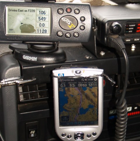
Newest receivers use street maps to lead you to an address you have never before gone to. Giving vocal directions like “take second right at next roundabout”. Off road users find maps with tracks and rivers along with height lines and hut locations of more use.
From the time the US Department of Defense stopped corrupting the signals for civilian use accuracy in GPS systems has improved a lot. Around 5-10 meters (12-24 feet) horizontally and 20-30 meters (50-70 feet) vertically. WAAS technology used in the United States improves these numbers significantly.
For major trips I recommend you also take an old fashioned hand held compass along as backup if the portable GPS navigator fails – that can be a lifesaver.
[author]