
GPS Iceland Map
GPS Iceland
GPS has become the preferred method of navigation in Iceland. Large areas have hardly any inhabitants and the highlands have almost none. The dangers of the terrain in addition to extreme weather conditions make secure navigation a must. Advances in GPS Iceland mapping therefore makes traveling more secure and more informative.
GPS Iceland Map
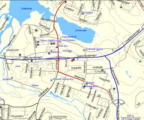
Reykjavik East
R. Sigmundsson ehf. in cooperation with the engineering company Hnit and Samsyn have introduced version 3.0 of their GPS map of Iceland. The map includes street maps of most towns and villages in Iceland, a database of location names and services along with detailed altitude lines of the mountainous terrain.
This GPS map is definitely one of the best available map for navigating in the Icelandic highlands as well as in streets. The map can be used for standalone GPS systems, PCs, handhelds and even smart phones.
The GPS Iceland Map is based on a map data from the National Land Survey of Iceland. The original scale is 1:50,000 with altitude lines for every 20 meters, rivers, roads and trails.
This single map serves for various tasks from finding your way to a specific address in the non obvious routes in Reykjavik and other towns to traveling around less populated areas as well as the more advanced highland and mountain navigation.
Navigating Iceland
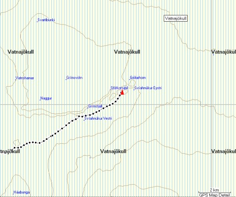
Grimsfjoll in Vatnajokull ice cap
GPS Iceland map is useful for navigating Iceland. It has a detailed street map of most towns with individual house numbers, public roads and highland trails. It can be used to calculate the shortest or the quickest route between two places.
Having 40,000 names of locations and more than 4,000 service providers as well as highland hut locations. Finding the closest swimming pool, golf court, camping site, shop, restaurant, library, petrol station, hospital, theatre, skating hall, airport, cinema, bowling alley or kindergarten is easy.
The detailed altitude information gives the GPS Iceland map more depth and shadowing increases the visual effect making the map appear three dimensional. This is important for highland navigation where you often have low visibility and want to know about dangerous changes in the terrain.
The software is available from:

Thrandur
4x4OffRoads.com